MOUNTAIN BIKE ITINERARIES
BIKE AND MTB ITINERARIES
CHOOSE THE MOST SUITABLE ROUTE FROM OUR 8 ROUTES
ITINERARIES 1
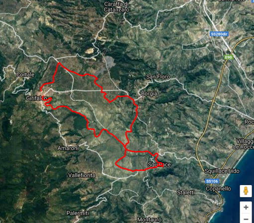
Girifalco and Squillace - From the Saracens to the Normans
Start of route from the Oasis: approximately 20 km. (Shockwave Itinerary)
The route will have a total length of 35 km, 90% of which will be on dirt roads.
Note: Pay attention to the route because during the ondadurto stage there were signs on the route indicating:* Arrows of the fork to take.* Two-coloured ribbons.
It starts at the Girifalco Sports Field and continues by walking around the village, passing by the “Old Poplars”.
Moving on, you will arrive in the “Toco” area. The Toco is situated at about 400 m above sea level, 1.5 km from the town of Girifalco in the centre of the Isthmus of Catanzaro (the narrowest point in Calabria and the Italian peninsula), known as “the land of the two seas” because it is lapped by the Ionian and Tyrrhenian seas. In fact, from Monte Covello it is possible to admire both seas and ‘Caria’, which is considered an important archaeological area, as a necropolis dating back to the Upper Neolithic was found, with part of the National Museum of Reggio Calabria dedicated to some archaeological finds from the area.
It passes through the “judice mare” locality and then arrives in Squillace with arrival in Piazza Duomo.
Then we descend via the “Ponte Ghetterello” (known as the Devil’s Bridge or the Witches’ Bridge) and continue to the “Promontorio” (pine cone area) in the “Cannavù” district and return to Girifalco.
Restaurant : Monte Covello Park, a short distance from the starting point, accessible by car.
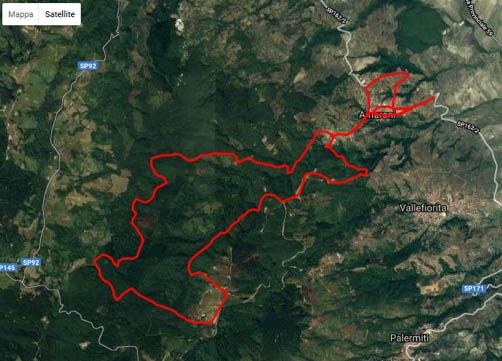
Amaroni - honey and olive oil
Start of route from the Oasis: approximately 16 km.
The route, of medium-high level, is structured for 80% on dirt roads, between the mountain paths of the municipalities of Amaroni and Girifalco. This is a 29 km route that winds its way along paths and single tracks through beech, chestnut and oak forests. This is a demanding route, but one which is accessible to all and which also meets the needs of more experienced bikers. It is advisable to be well trained in order to tackle the entire route, which has a difference in altitude of around 900 metres.
After the start at the ‘Nicolas Green’ municipal amphitheatre in Amaroni, the route winds its way through the streets of the historic centre to continue through the Ferrera woods, ending at 8 km.
From here we continue along a spectacular single track of chestnut trees that ends at the Monte Covello forestry house.
We will continue through the Ceddia woods, reaching the highest point of the route (950m). From here a technical descent begins that will take the bikers to admire the Parco degli Schiavi along the wind turbines. The descent will proceed towards Amaroni, always on a dirt road and also crossing a small stream.
Aspects of naturalistic, environmental, historical, etc. interest.
Amaroni, cradle of an ancient tradition that, for generations, has involved entire families in honey production, immersed in an uncontaminated Mediterranean area, among valleys and flowering meadows, produces the good honeys of Calabria.
With their intoxicating flavours and colours reminiscent of the warm sun in a clear sky, these honeys, rich in history and dedication, offer unique emotions and authentic sensations.
The ‘Società Calabria Produce’, based in Amaroni and with a great history handed down through the generations, started back in 1900 when grandfather Paolo BOVA began working as a beekeeper, managing a heritage of 300 beehives.
In 1987, partners Paolino and Carlo decided to set up two individual beekeeping companies and actively dedicated themselves to the production of honey and royal jelly; this individual path led them to the merger of the two companies into a single company, called Calabria Produce sas. http://www.calabriaproduce.it/dovesiamo.html
Today, an agricultural company called MANCINI DANIELA SRL has been set up, with a beekeeping heritage of 530 hives, conducted in a nomadic manner and diversifying the activity not only with traditional beekeeping products but also with additional services such as providing accommodation in the Educational Farm for schoolchildren and/or organised groups.
Loc. Manca del Bosco Amaroni (CZ)
Reference for info: Daniela (tel. 0961 913177)
Today, the three companies constitute a clear and strong direction for the entire provincial basin and beyond, attracted by history, culture and quality, and recognised throughout the region as ‘Bova Group Honey’. Moreover, thanks to the three companies and other businesses in the Amaron area, Amaroni is now a full member of the Great Honey Cities, an institutional recognition of which to be proud, not least because only two municipalities in the entire Calabrian region have received this great accolade.
The route, of medium-high level, is structured for 80% on dirt roads, between the mountain paths of the municipalities of Amaroni and Girifalco. This is a 29 km route that winds its way along paths and single tracks through beech, chestnut and oak forests. This is a demanding route, but one which is accessible to all and which also meets the needs of more experienced bikers. It is advisable to be well trained in order to tackle the entire route, which has a difference in altitude of around 900 metres.
After the start at the ‘Nicolas Green’ municipal amphitheatre in Amaroni, the route winds its way through the streets of the historic centre to continue through the Ferrera woods, ending at 8 km.
From here we continue along a spectacular single track of chestnut trees that ends at the Monte Covello forestry house.
We will continue through the Ceddia woods, reaching the highest point of the route (950m). From here a technical descent begins that will take the bikers to admire the Parco degli Schiavi along the wind turbines. The descent will proceed towards Amaroni, always on a dirt road and also crossing a small stream.
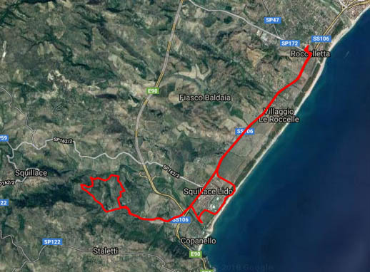
Copanello di Stalettì
Start of route from the Oasis: approx. 6 km. (Shockwave itinerary)
Difficulty of the route: The first section is on the asphalt SS106, from the Caffè Guglielmo establishment to the last section is for cyclists with excellent technical skills due to the high gradient and the uneven ground.
Starting from the Governor’s Oasis, follow the S.S. 106 for a while in the direction of Soverato until you reach the Guglielmo Coffee Plant; behind the plant there is a small stone road that climbs up to Staletti. The last section becomes very technical as the gaps between the stones are wide and there is a high risk of getting your tyres caught between the stones. If you can’t do it, you can push it.
Aspetti di interesse naturalistico, ambientale, storico, ecc.
The origin of Stalettì dates back to Roman times, as shown by the numerous archaeological finds in the area. Near the village’s main street, Via Grande, there are old lime kilns and a watchtower overlooking the surrounding area. In the 1400s, the village underwent an important demographic increase that was interrupted years later by Saracen raids.
An earthquake in 1783 caused extensive damage to the town and in particular to its cultural heritage.
David Maximilian Gualtieri
email: d.gualtieri@libero.it
Available by prior contact.
ITINERARIES 2
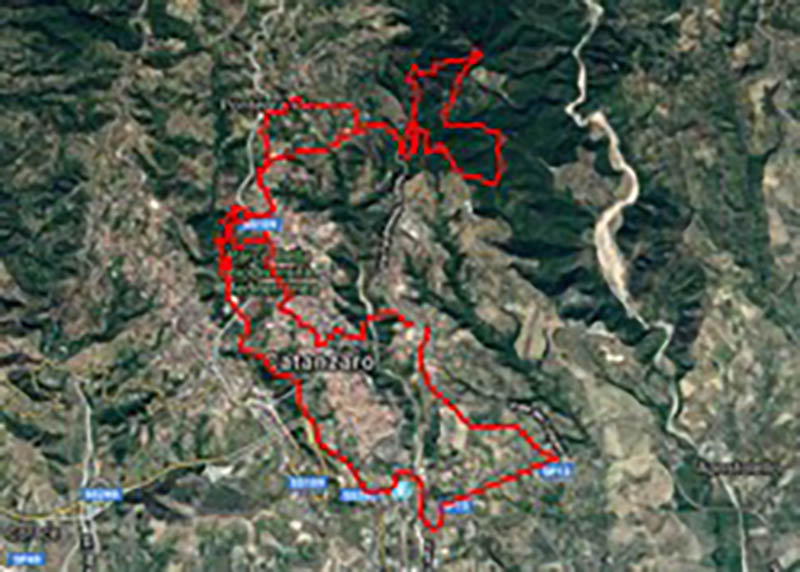
Fiumarella stream-Biodiversity Park-Siano pine forest
Start of route from the Oasis: about 15-20 km. (Shockwave itinerary)
The route runs through the two lungs of the city of Catanzaro, where you can admire places of natural/environmental interest as well as various species of fauna.
Departure from Catanzaro Sala, up the Fiumarella Torrent to the Maneggio and then up the narrow streets of the old mines to the Biodiversity Park. On asphalt you reach the other lung of the city – the “Li Comuni” woodland park (Pineta di Siano) and then close the route in the city centre.
David Maximilian Gualtieri
email: d.gualtieri@libero.it
Available by prior contact.
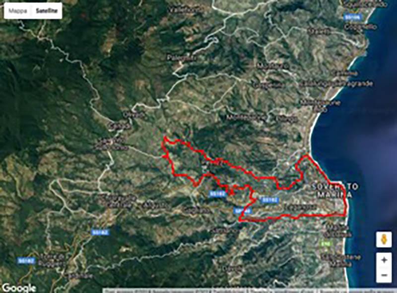
SOVERATO - Between the Ancinale and the Beltrame: from the old Calabrolucana railway to Soverato Vecchia
Start of route from the Oasis: approximately 16 km. (Shockwave Itinerary) .
Il percorso consiste in 70% di strade di ghiaia e 30% di asfalto. Long route 36.9km
Route description: The route starts from the seafront near the Villa Comunale and will take us to the AFOR reserve, an area designated for reforestation that includes nurseries of maritime pines, palms and eucalyptus; we will then reach the mouth of the Ancinale river and climb it until we reach the hydroelectric power station, where we will cross the road that leads to the old toll booth of the abandoned Calabrolucana line.
From here on we follow the old railway line for a good distance and enter one of the four impressive tunnels along the way.
Following the old railway line, we arrive at the ancient and well-preserved Convento della Pietà, founded in the 17th century. 15th century, by Blessed Francesco da Zumpano and built on even older structures.
Our route continues along the old railway track, which we only leave when we reach the San Vito countryside, after crossing a bridge on the old railway line.
Another short stretch of asphalt and we meet “Murorotto”, an ancient Norman dam, a place of worship and legends, which testifies to the ancient origins of these places. Now we head towards Petrizzi, where we will take a tour of the characteristic narrow streets and the old town, passing under the “e jusu” gate, a gate that closed off the town from the south and that served so well against the Saracen invasions.
After a bit of asphalt descent, we take the dirt road that will lead us to the archaeological site of “Soverato Vecchia”, the old town centre destroyed by the earthquake of 1783.
It is now time to return to Soverato Marina and conclude the loop on the seafront again.
The route is entirely surrounded by Mediterranean scrub and we pass through olive, orange and strawberry trees.
If you follow the route of the railway, you will not encounter any steep sections.
In “Murorotto” the Madonna della Luce is venerated and is a place of pilgrimage. According to the traditional story, San Vito broke the wall with his sword to make the water drain away, and the village that still bears the name of the prodigious saint was born.
Places to eat :
for a fresh fish lunch “Lido San Domenico” restaurant
sample menu: mixed seafood starter, swordfish and aubergine lasagne, gulf fry, salad, Calabria lemon sorbet, fruit, water, wine.
By prior request, alternative menus for vegetarians, vegans and coeliacs.

Two seas excursion the historic centres of Tiriolo and Gimigliano
Start of route from the Oasis: about 30 km. (Shockwave Itinerary)
To get to Tiriolo: whether you are coming from the Tyrrhenian or the Ionian Sea, take the SS 280 dei Due Mari, exit at Marcellinara and from there follow the signs for Tiriolo.
The tour is about 30 km long, with medium-high athletic difficulty and medium technical difficulty.
It is worth starting with a tour of the historic centre of Tiriolo, which is one of the 10 most beautiful in Calabria, and then climbing up to Mount Tiriolo (848 metres above sea level). It is worth starting with a tour of the historical centre of Tiriolo, which is one of the ten most beautiful places in Calabria, and then climb up Mount Tiriolo (848 metres above sea level) to admire (weather permitting) a unique panorama, with a view of the Ionian and Tyrrhenian Seas at the same time: looking out over the Serre Mountains, the Aeolian Islands, the foothills of the Sila, Catanzaro and half of Calabria (on particularly clear days you can even see Etna!), you can also admire the ruins of the ancient Byzantine fortress, the grotto of King Niliu, the Judecca, etc., etc.
Once back down, the tour will initially take the “Via dei Francesi”, and then turn towards Gimigliano. The centre, of medieval origins, is located between the Corace river valley and the foothills of the Catanzaro Sila.
After a tour of the town’s streets and alleyways, we head for the Sanctuary of the Madonna di Porto, located in the Corace valley and probably the site of an ancient river port.
Finally, we return to Tiriolo by taking the final part of the Via dei Francesi.
A Tiriolo in addition to the alleys, palaces and portals with their particular masks, there is the Antiquarium Comunale (Municipal Antiquarium). There, it is possible to admire (among other archaeological finds) the monumental Brettia tomb (4th century BC) and the copy of the very famous Senatusconsultum De Bacchanalibus (186 BC, found in Tiriolo in 1640). Then the adjacent Museum of Traditional Calabrian Costume, where more than 40 traditional Calabrian dresses (the famous “pacchiane”) are exhibited.
The Sanctuary of the Madonna del Porto is the largest sanctuary in the area and is home to the Patron Saint of the province of Catanzaro.
The interior of the new sanctuary features the image of the Madonna and the ‘Four Evangelists’ in Venetian mosaic, the presbytery decorated with artistic marbles, such as Siena yellow, Spanish alicante, golden onyx and German marmolit.
Gimigliano is famous above all for its green marble, used for the steps of the Gesù Church in Naples, for the floors of the Royal Palace of Caserta, for the winter choir and the niches of the Basilica of San Giovanni in Laterano, for the central square in St Petersburg and in many churches and buildings in Catanzaro and the surrounding area. Also worth mentioning is the Mother Church of Gimigliano, which houses the 17th century painting of the Madonna di Porto, crowned and blessed by Pope Paul VI and Pope John Paul II. Ruined by an earthquake in 1783, it was rebuilt in early 1796. The Renaissance-style façade was completed in 1912; it features beautiful monolithic columns of pink marble from Gimigliano and window and door portals of green marble, also from Gimigliano.
Place to eat:
Tiriolo – “Ristorante ai 2 mari” at the highest point in the village where cars can arrive.
“Colle del Signore” agritourism farmhouse, in the “Fondaco” locality, on the road from Tiriolo towards San Pietro Apostolo, about 2 km from the town.
ITINERARIES 3
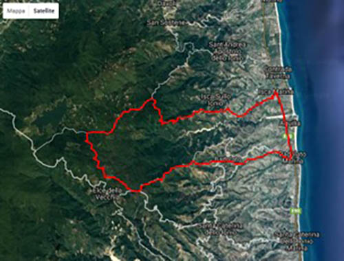
Badolato marina - Passo Colla - Piano dei Pecorai - Badolato: the evocative medieval village
Start of route from the Oasis: about 30 km.
Trail mostly on a gravel road
Length Km 38.7
Height difference 1250 m
Difficulty BC/BC (Good technical skills)
Description:
The starting point is Badolato Marina. Take a stretch of State Road 106 in the direction of Catanzaro until you reach Isca Marina, where you turn left at the first junction. Take the road leading to a holiday village and continue in the direction of the mountains. The road is tarmac for the first few kilometres and, after the Colla pass, a short descent, already unpaved, leads us towards the mountain.
The route of the dirt road is that of the aqueduct, so there is the possibility of refuelling at two fountains present. At the end of the dirt road, which climbs with several hairpin bends, you meet the asphalt road, which at the first fork climbs from Isca and at the next fork you turn left (the road on the right climbs from S. Andrea).
After a few kilometres, still on the asphalt road, there is a small clearing with water on the left.
We continue on, alternating between descents and ascents, until we reach a junction where we turn left and shortly afterwards left again onto a dirt road. After a series of ups and downs and a few forks in the road (there are also some water sources), we reach the Badolato forestry office on the asphalt road.
The road now descends asphalted to the left, is followed by a series of hairpin bends and a few straights. We must proceed carefully, because we have to turn at the second asphalted crossroads on the right, and it will take us right to Badolato (on a hill 240 metres above sea level). Badolato is a suggestive medieval village, characterised by a Byzantine layout, with numerous churches arranged in the form of a Latin cross and with many characteristic alleys.
We walk through the old town centre towards the splendid church dedicated to the Immaculate Conception: it is situated beyond the eastern gate of the town, on a hillock from which the view extends from Capo Colonna to Punta Stilo.
We return along the road that descends towards the Fiumara, where we can still see the ruins of a series of houses recently affected by a flood (1951).
We take the dirt road back to Badolato Marina.
Badolato is the land of churches. In the village, 13 churches can be visited, which, due to their position, almost seem to protect the village from all four sides.
The Church of the Immaculate Conception is not open; begun in 1686, it has a granite portal attributed to stonemasons from Serra San Bruno. Two columns on a pedestal, placed on either side of the entrance hall, support an architrave with a niche in which the year of the church’s foundation (1686) and the year of its restoration (1859) can be read.
Inside, it has a ceiling, with plaster stucco, decorated by artists from Serra San Bruno. The barrel vault is divided into three panels, interspersed with bands of flowers. A medallion is placed in the centre of each square. The background of the vault is blue, with white and gold floral and volute decorations. Near the apse is the dome in the form of a simple octagon pierced by a series of windows.
The dome, which ends in a star-shaped lantern covered with terracotta tiles on the outside, is one of the most important examples of 17th-century Badolese architecture.
The high altar is made of white marble and the floor is tiled with daisy designs. On the left wall is an oil on canvas depicting the Angelic Cross by Thomas Aquinas and several works by Neapolitan and local artists.
The silver pieces (chalice, monstrance, tip of the prior’s mace) were made by Neapolitan artists. On the outer wall of the apse is a majolica panel (1800) depicting the Immaculate Madonna (made in Squillace).
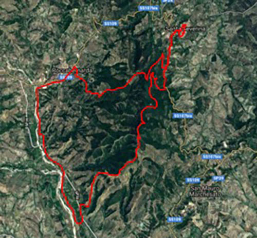
Santa Severina – Roccabernarda
Start of the route from the Oasis: 65 km or 85 km depending on the route chosen. (Shockwave Itinerary)
North-eastern area of the Crotone area, route with several panoramic and belvedere points, Monte Fuscaldo, site of naturalistic importance
Difficulty of the route BC: (for cyclists with good technical skills)
Description: departure from the moat of the Norman castle of Santa Severina where there is ample parking for cars. Pass through the old town centre and follow the main road towards San Mauro Marchesato for about 1 km, then start the climb to the top of the ridge and the belvedere with a view of the north-eastern area of the Crotone Marquisate. Here you can enjoy a splendid panorama of Santa Severina.
Immediately after this stop, the green area of M. Fuscaldo is reached.
The route then follows the eastern side of the mountain at a good height, on a wide forest track with beautiful views over the Crotone countryside and as far as the sea.
After passing the branch-off for the summit of Fuscaldo, the summit of the ring is reached at Timpa della Zita. From here we have a splendid view of the Niffi Valley below, a natural treasure carved out of sandstone walls and a nesting place for kestrels, buzzards, owls and other birds of prey.
We set off again in the direction of Timpa del Corvo, through old fences and pastures, from where there is a breathtaking view of the sheer walls of the valley.
We start out again on a scenic, steeply sloping stretch along a narrow ridge bordered by fields of trees and olive groves that will take us directly into the orange groves of the middle Tacina river valley.
Amidst splendid scents of orange blossom and seasonal fruit, we will walk along the Tacina river until we reach the village of Roccabernarda.
We tackle the ascent of Mount Fuscaldo and the subsequent descent to the starting point, i.e. Santa Severina.
Santa Severina: visit the Norman castle of Robert Guiscard, the Cathedral, the Baptistery and the Diocesan Museum. The narrow streets of the village are also of considerable interest.
Description of the Monte Fuscaldo area
Mount Fuscaldo is the highest point of the ridge that rises in the Marchesato Crotonese and acts as a watershed between the valleys of the Tacina and Neto rivers, between the Sila mountains and the Ionian Sea. The summit reaches a height of 565 metres and with its grandeur seems to want to protect the historic town of Santa Severina and its ancient castle. The entire ridge is characterised by slopes furrowed by valleys, canyons and bordered by steep sandstone walls. These walls are carved by deep incisions of wind origin and offer the possibility of nesting to numerous species of birds of prey (some of which are very rare and in danger of extinction on the national territory), such as the Egyptian Vulture (Neophron percnopterus), the Red Kite (Milvus migrans) and the Eagle Owl.. For this reason, the area, which has an extension of about 2,500 ha, has been included in the list of Sites of Community Importance (SCI) of the Natura 2000 network. The vegetation is classic Mediterranean scrub, with parts woodland and parts garrigue, depending on edaphic, orographic and microclimatic conditions. The most common species include mastic, myrtle, phillyrea, alaterno and arbutus, often associated with hawthorn, perastro, blackthorn and wild olive. Some beautiful and rare areas at the climax stage, including the spectacular Valle Niffi, where the oak forest predominates, consisting mainly of Holm oaks and Downy oaks. The once widespread cork oak is also represented by a few specimens. The Mediterranean scrubland is interspersed with many olive groves. There are also numerous archaeological sites scattered throughout the area dating from the protohistoric age to the late Middle Ages. Sites that testify to the great interest of the Marquisate’s people in this area for economic, military and religious reasons.
ITINERARIES 4
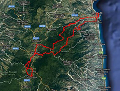
Soverato - Serre Natural Park - Soverato Lacina Lake
Start of route from the Oasis: 16 km. (Shockwave Itinerary)
Challenging route with a lot of climbing, about 3150 over 104 km. The route is divided between 30% asphalt and 70% dirt roads, woods and gravel.
Water is available along the route. First fountain at the beginning of the village of Satriano, calculating that the start is in Soverato in P.zza M. Ausiliatrice, second fountain will be in the middle of the pine forest of Satriano, famous and known by all. You enter the Serre nature park, along the way you will come across at least 2 more drinking water fountains, until you reach Lacina Lake, continue to Brognaturo and you can make a mini stop at the bar or to stock up on water.
We start again in the direction of Serra San Bruno on the road for about 4 km; stop at “Il Fornaio” for a pizza and a nice cold beer, then continue in the direction of Certosa and re-enter the woods in the direction of Mongiana, a path through the woods and dirt road where it is possible to refuel with water again inside the park “Scuola Corpo della Forestale”. On the way back we follow the same route, but with a few changes: we head towards Serra San Bruno, with another stop at “Il Fornaio” (the baker’s) and then we come across a lovely 7-8 km long climb, “Contrada Pezzante”, until we re-enter the Serre park in the direction of Lake Lacina on the west side to reach the famous San Tonino stone. Preliminary remark: it is advisable to make little use of water as from the Lacina stretch to Pietra San Tonino there are no more drinking fountains, the next one you will meet going down from San Tonino to Davoli Superiore.
Buy a bottle of water for reserve in Serra San Bruno. From San Tonino we pass through Davoli Sup. and on to the starting point of Soverato. Arm yourself with patience, bars and supplements because the route is long and demanding. Not recommended for occasional mountain bikers.
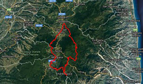
Tours in the Serre Natural Park
The Ferninandea residence, the megaliths, the ponds
Start of route from the Oasis: 50 km (Shockwave Itinerary)
Challenging route of around 57 km.
Departure from the square in front of the Charterhouse of Serra San Bruno.
Almost immediately, however, there is a long, steep climb through the luxuriant nature of the park that leads to the first point of interest, the Ferdinandea, a Bourbon residence.
We continue to climb up to the summit of the Serre, Passo di Pietra Spada, at an altitude of 1351 m and then descend, on asphalt, to the village of Nardodipace. Here it is possible to visit the megaliths.
A very long and demanding descent to the Allaro torrent and then a steep climb towards Fabrizia.
Another stretch of transfer to Mongiana where the small lakes are located.
Last climb and then downhill to Santa Maria del Bosco
ITINERARIES 5
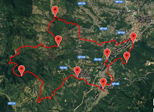
Cardinale - the forest, the trout lake, the Razzona ironworks, the Ancinale river,
Start of route from the Oasis: about 35 km or about 40 km depending on the route chosen. (Shockwave Itinerary)
The route covers about 32 km, with a total difference in altitude of 370 metres, of which only 5% is on asphalt, distributed throughout the entire tour, in the midst of dense oak and beech woods, beautiful wetlands, delightful lakes and spectacular viewpoints. It covers the municipalities of Cardinale, Torre di Ruggiero, Chiaravalle Centrale and Vallelonga, the last of which is in the province of Vibo Valentia.
We will start the tour by stopping at what remains of the link between the Augustinian convent of Torre di Spadola, founded in 1534 and dedicated to Santa Maria del Carmine, and the convent of San Basilio, built by the monks in a green basin caressed by the Bruca river at the behest of Ruggiero Normanno.
We continue our tour through the woods to reach the trout pond, where we can stop for a snack; we continue in the direction of the municipality of Chiaravalle Centrale to reach the ruins of the Filangeri Castle or Castello della Razzona and its ironworks, destroyed by earthquakes and floods, but with a very important history behind it. Along the Ancinale river, which brought water necessary for the operation of the ironworks, we arrive at the Rotiroti farm, from where we continue for the last kilometre to the sports field.
The ironworks was certainly already active with the principality of Satriano granted on 10 May 1611 by King Philip IV of Spain to the Ravaschieri Fieschi family. More precisely, the transfer was made to Ettore Ravaschieri, Duke of Cardinale.
The evidence of Carlo’s most incisive commitment in the Razzona district, remains the construction of his private ironworks, which, according to the Neapolitan engineer Luigi Giura, dates back to 1824.
The Razzona ironworks is part of the ancient tradition of Calabrian foundries, which had been active since the year 1000. From the end of the 18th century, they had had a vigorous boost with the royal ironworks and the Montana foundry, dating back to 1771 according to some manuscripts. He grew rapidly, started with a single three-flame forge and after ten years had three forges and eight fires. It employed about 200 workers. The first two Italian suspension bridges, built in 1829 over the Garigliano and Calore rivers, have iron structures made in the foundries of Razzona di Cardinale and Mongiana. During these years, the Bourbon ironworks made Cardinale ‘an industrial centre’. The Razzona ironworks was almost completely destroyed by a flood in 1855 and dismantled after Garibaldi’s invasion.
There were also spinning mills in Cardinale, known locally as ‘vattandìari’, where various natural fibres, including wool, were processed. This was used to produce a waterproof fabric called ‘arbascio’, which nobody knows exactly how it was made anymore.
Today, the forestry industry is an important source of income with the exploitation of vast chestnut, beech and coniferous forests. In the past, silkworm breeding was practised in Cardinale and the white mulberry (Morus alba) was cultivated on a large scale.
Territory
The municipality is situated about 560 m above sea level and about 60 km from the capital Catanzaro. The territory is mostly wooded. The prevailing autochthonous forest species are chestnut, oak and beech. In the 1950s and 1960s, extensive reforestation with conifers (mainly pine) was undertaken.
The historical centre is washed by the Ancinale river (the ancient Cecinus), which rises from Monte Pecoraro at Pietre Bianche and flows into the Ionian Sea near Soverato, after a distance of about 35 km. Along the course of the river there is an important station of the fern Osmunda regalis.
Cardinal is also a Neolithic site. As early as the 19th century, worked stone axes were found during work on the reinforcement of an iron bridge. Many of these have been found in various locations. Tradition has it that shepherds considered them to be thunderbolts and carried them with them, as they were believed to be a powerful talisman against lightning. Such axes were called ‘cugni’ or ‘truoni’. Some of these axes are kept in the Crotone Museum. These findings prove the presence of man in the Ancinale Valley since the Neolithic age.
The historic centre is rich in various granite artefacts (portals etc.) and there is a beautiful 18th century church with an imposing façade.
In the territory of the municipality and neighbouring municipalities, hazelnuts were cultivated on a large scale until a few years ago. Currently, this activity is much reduced due to the depreciation of the product and the sharp increase in labour. This plant was imported from the Atripalda area by Alfonso Salvi in the mid-19th century.
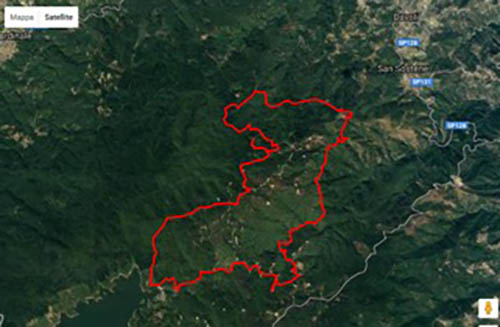
Cardinale - the forest, the trout lake, the Razzona ironworks, the Ancinale river.
Start of route from the Oasis: 25 km (Shockwave Route)
The village of Davoli Superiore, the stone of Sant’Antonino and the shepherd’s breakfast.
A journey into the pastoral culture near one of the most important rivers in the Ionian region of Calabria.
In the heart of the Calabrian greenhouses, an entirely mountainous and unpaved route.
Starting at an altitude of 1,000 metres above sea level, we follow a road that runs alongside the Alaca River, immediately entering a breathtaking landscape that will prove to be enchanting and wild.
Leaving the fiumara Alaca we will go, crossing part of the San Sostene wind farm, to the Sant’Antonino stone, an enormous monolith considered a place of worship and legend. In fact, near the monolith stood the monastery of the Virgin of Pietra Santa and a small hermitage, now unfortunately destroyed. The stone also holds several legends that will be revealed at the stop.
The tour ends in the place of departure, precisely in the locality of the forest, where you can climb up to the forestry “lookout” and admire the entire Gulf of Squillace.
The next stop is the characteristic village of Davoli Superiore.
In the vicinity of the Sant’Antonino stone, you might happen to taste the famous ‘mpanata, the shepherds’ breakfast of bread and sheep’s milk whey. The ‘mpanata was once necessary for the shepherds to get through the hard days of work, and they ate it in the morning before taking the animals out to pasture.
Typical local dishes: pasta with salted meat, baccalà alla davolese, pipi e sardi and graffioli, all washed down with excellent local wine.
ITINERARIES 6
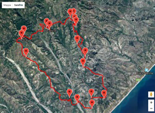
Stignano - A route rich in environmental, cultural and culinary treasures.
Start of the route from the Oasis: 60 km SS106 or for hilly roads 90 km
(Shockwave Itinerary)
Difficulty of the route (medium), with asphalt and dirt sections, approximately 31 kilometres with a maximum altitude of 369 metres, accumulated 985;
Estimated walking time 4:30:00 including stops.
This is a free excursion open to all mountain bikers with a fair amount of experience and training.
Description of the route: starting from Piazza S. Pietro di Stignano, walk along a stretch of the historic centre and continue along the road that runs alongside the fields for about 700 metres. We cross a small village and short stretches of paved road, then continue along a field track to the contrade Colture junction; we turn right and continue along the paved road until we pass the sheds of the former Varda water factory on the left and turn left onto a track that leads to the San Fili castle. We then walk a short distance.
Now descend along a short, steep track until you cross Provincial Road 92 and then turn left onto it. We turn further to the right onto the Favaco district road, reach a construction site where we can admire the processing of aggregates and then turn left to cross the Precariti stream (Km 12.000). We will continue straight ahead until the crossroads where we turn right to continue along Via della Trinità and a little further on turn left (Km 13.100) where the dirt track begins that will lead us over the hills towards the Sanctuary of the Madonna dello Scoglio di S. Domenica; this section will be characterised by uphill and downhill stretches and a descent that will end up intercepting the tarmac road (Km 19.200) which continues uphill to the square of the Sanctuary. Translated with www.DeepL.com/Translator (free version)
We climb up to cross the houses of the village and descend immediately after the bend on the left (Km 22.100); we continue and cross the Precariti torrent and then climb up towards Placanica.
Return to Stignano, where, having passed the cemetery, you will find the convent of S. Antonio on the left; a steep asphalted descent reaches the crossroads where, turning left, you descend to the sports field.
Stignano
Chiesa Matrice “Parrocchia Annunciazione”, where you can see the Cozza Shovel and the marble half-bust of Santa Barbara.
Piazza Forzio, enhanced by a wonderful belvedere of the valley bordering the sea
Continuing along Via Forzo, the heart of the village, you can admire the characteristic “Lammie” (arcades) until you reach Piazza San Rocco, with the church of the same name.
If you walk up Via Roma, “la Pitta China”, you will come to Piazza Tommaso Campanella, where you will see the house of the philosopher Tommaso Campanella.
Local Cuisine: “Liquorice” typical liqueur Pasta alla Stignanese”, “Tripe” and “Wild Vegetables”. without forgetting the “Porchetta” and the innovative “Decotto di Foglie d’Ulivo”.
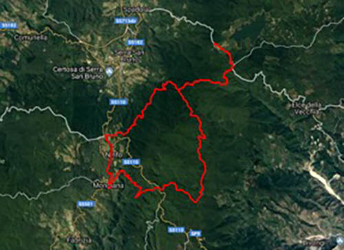
The itinerant ironworks - Serre Natural Park - Lacina- Brognaturo
Start of route from the Oasis: approximately 45 km or 60 km depending on the route chosen (Shockwave Itinerary)
The route will have a total length of 45 km, 90% of which will be on dirt roads.
Good physical fitness is recommended and there will be the possibility of water refreshment at several springs along the route.
How to get there:
From the S.S. 106 coming from Catanzaro continue towards S.Andrea Apostolo dello Jonio after two km turn left towards piano dei Pecorai – Serra S. Bruno
Distance: 45.2 km
Beware of the route, the stage had fork arrows to take, two-coloured red/white ribbons.
Departure is from Hotel della Lacina, Loc. Lacina, Brognaturo, you walk along paths that lead to higher altitudes and then descend through majestic conifer and beech forests. A short stretch of asphalt road leads to the historic centre of Mongiana.
The itinerary continues along a partly uphill and partly downhill track to the summer residence of Ferdinand IV, the “Ferdinandea”. We continue through the woods to the starting point.
In Mongianasi there are the ruins of the former arms factory dating back to the 18th century, the foundry with the blast furnace and the remains of the water mill, the workers’ fountain and some historical artefacts kept in the Proloco headquarters.
The Mongiana ironworks was founded during the reign of Ferdinand IV of Bourbon, and has ancient origins (Phoenician foundries) of which numerous traces remain in the area between Stilo and Serra San Bruno.
The ancient inhabitants exploited underground resources on site, smelting copper, lead and iron. The Pazzano mines, from which limonite, an iron-rich mineral, was extracted, supplied the Mongiana foundries with raw material, thus becoming the hub around which the Neapolitan iron industry developed. The huge demand for fuel made the ironworks nomadic industries in pursuit of forests to be charred. The so-called Itinerant Ironworks, because the destruction of the forests around them sent the mouths of the furnaces on their way in search of new forests to devour. In 1771, after the destruction of the Stilenese woods, the ovens reached the locality of “Cima”, later called “Mongiana”, after the name of a stream that flowed on the Piana S. Micone, in the middle of dense woods. In the 17th century, a true Calabrian iron and steel district was born, including Mongiana and Ferdinandea with three blast furnaces: Santa Barbara, San Ferdinando and San Francesco, various workshops along the course of the Ninfo and Allaro rivers. There was also a weapons factory that produced rifles, bayonets, accessories, sabres and daggers until 1864; in addition to weapons, the tracks of the Naples-Portici railway line, the first iron bridges and the same cast-iron columns at the entrance to the weapons factory were built here.
Today the building is in the final stages of restoration for the creation of a Territorial Museum.
We also recommend a visit to the Villa Vittoria Park in Mongiana, where you can see more than 200 specimens of medicinal plants, very common in the area, divided into medicinal, poisonous and aromatic. The fauna consists of Haflinger and Morgue horses, wild boar, mouflon deer, deer, roe deer, pheasants and peacocks. Birdlife includes buzzards, barn owls, magpies, crows, hazelnuts, woodpigeons, wrens, jays and green woodpeckers. This is managed by the State Forestry Corps.
Summer residence of Ferdinand IV the ‘Ferdinandea‘, a visit to the inner park of the residence and the various coats of arms.
ITINERARIES 7
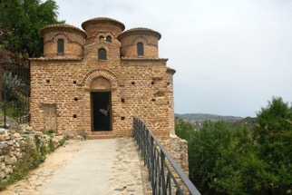
Stilo, the village between sea and mountains
Start of route from the Oasis: 60 km.
Stilo (or stilu in Calabrian) is located at the foot of Mount Consolino, at an altitude of 386 metres… with a view of the sea, the crystal-clear sea that falls within the municipality of Monasterace Marina. The clear, warm (but not too warm!) day is ideal for starting our cycle route from the sea to the mountainsof this little-known Calabria.
A warm breeze blows in from the sea and is lost in the hills behind Stilo. Cycling slowly in the plain of the Stilaro torrent, which will soon flow into the Ionian Sea, we look around in ecstasy: the unspoilt nature of this part of Calabria leaves us breathless, encouraging us to open our eyes even wider, despite the fact that the mid-May sun is already tenacious and insistent in wanting to annoy us. Stilo is just two pedal strokes away and, with each passing moment, we get closer and closer, riding along the SS110 on secondary roads that get lost in the valley.
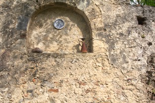
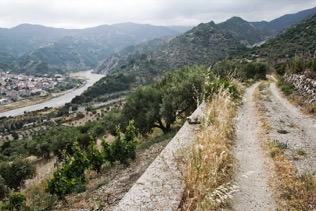
We cross the Stilaro River, which silently invites us to take a refreshing dip, and in contrada Manica we begin the ascent towards the hilltop village. A few hairpin bends with never-excessive gradients and we are in the square. Stilo looks like a village from the 1960s, alive and vibrant. The best known building in this village, and also the destination of the first part of our cycling trip, is the Cattolica, a small, very picturesque Byzantine church dating from the 9th century! I arrive in La Cattolica sweating like a wet rag: no one had warned me about the last climb! I take a breath, pretend to scan the horizon to recover the breath lost in some pedalling on the road, then I realise that the panorama is truly enchanting with the green of the meadows fading into the intense blue of the sea. It was definitely worth getting up here! A quick tour of Stilo reveals pretty corners that tell stories of times gone by.
DOC WINE AND ANCIENT MONASTERIES
Our cycle route continues around Stilo, which we begin to explore as soon as we leave the pretty hilltop village. The presence of the Stilaro is a sure and thunderous constant in this part of the route: the snows are melting rapidly from the mountains and the waters, which for most of the year appear placid, are now particularly vigorous. We continue blissfully on Via Concordia, in the direction of Bivongi ready to take the turning on the right along the the Pardalà stream, which we will then leave behind to climb the road in search of the Greek Orthodox Monastery of St John Theristis. Under Byzantine influence until the 9thcentury, Calabria still preserves unimaginable treasures in the numerous remains of monasteries close to Aspromonte.
The one dedicated to St John Theristis was built in the 11th century and was
the home of learned and erudite monks until the 15th century, when its decline began. Abandoned for centuries, it was rediscovered almost by chance at the beginning of the 1900s. The monastery of St. John Theristis was the first to be founded directly by monks from Mount Athos and this is a record to be proud of! Today it is owned by the municipality of Bivongi, which has given it into the custody of the Romanian Orthodox Church in Italy for 99 years.


We cross the Stilaro River, which silently invites us to take a refreshing dip, and in contrada Manica we begin the ascent towards the hilltop village. A few hairpin bends with never-excessive gradients and we are in the square. Stilo looks like a village from the 1960s, alive and vibrant. The best known building in this village, and also the destination of the first part of our cycling trip, is the Cattolica, a small, very picturesque Byzantine church dating from the 9th century! I arrive in La Cattolica sweating like a wet rag: no one had warned me about the last climb! I take a breath, pretend to scan the horizon to recover the breath lost in some pedalling on the road, then I realise that the panorama is truly enchanting with the green of the meadows fading into the intense blue of the sea. It was definitely worth getting up here! A quick tour of Stilo reveals pretty corners that tell stories of times gone by.
Walking in this mystical place is an unusual experience: learning about the history of the monastery, imagining life in these places in the mountains, the difficulties, the dark times… and then suddenly finding yourself catapulted into the monastery in the 21st century! All this suggests…
Pedalling backwards on the asphalt in the direction of Bivongi, I notice by chance the sign indicating the path towards the Monastero SS. Apostoli.
A few pedalings and the ruins barely appear among the brambles and undergrowth: here Nature is reclaiming the space that was taken away from it centuries ago by this structure that has now been abandoned by all…
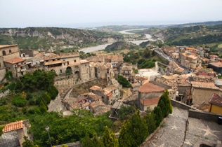
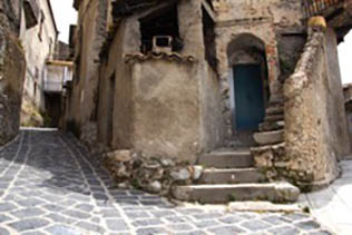
Who said that a good glass of red wine is not allowed when cycling?
Bivongi boasts an excellent DOC wine, a red born from the vineyards of this fertile area of Calabria, a wine that we just can’t miss on a bike ride through these parts! Extending the break by half an hour, we were able to allow ourselves the privilege of tasting the tasty bergamot juice, which we can’t find here… unfortunately!
A cycle path away from traffic
From the centre of Bivongi, a winding road climbs in the direction of Pazzano: there are almost 200 metres of difference in height to reach the least inhabited village in the Valle dello Stilaro and in the early afternoon sun it is really tiring. While cycling through the maquis I catch a glimpse of a hare hopping around in a bush, what an encounter! The remains of theold iron and steel industry in Calabria have left indelible traces here. Several mills can be visited but everything seems to be an old memory. In the municipality of Pazzano, there in the mountains, springs the Stilaro torrent, which in its short journey to the sea has created the valley dominated by Stilo.
In the village they are friendly and amazed by our presence: there are not many cycle travellers who venture deep into the Calabrian hinterland and the impact with this reality is really intense and involving. From Pazzano we decide to go back towards Stilo by going down the Via Nazionale, thus avoiding the SS110. Calabria is impressive: as soon as you leave the coast and venture a little inland, you come into contact with curious and incredible realities. For your cycling trip, bring your tent and try to experience Calabria in the most essential and spontaneous way possible, following your ideal cycling rhythm and enjoying the natural beauty that this land has to offer.
What to eat: during a cycling trip in Calabria you can’t leave out the gastronomic richness of the territory: in the area of Stilo, following our cycle path, you will come across typical trattorias and taverns where you can taste typical dishes of the Calabrian tradition… get ready for tasty and a bit spicy dishes!
Try: pasta e casa, pasta with snails (pasta e lambà), pecorino, parmigiana and soppressata. One tip is to stop at the baracchino outside la Cattolica, which offers Calabrian cold cuts at honest prices with a view of the Stilaro valley!
ITINERARIES 8
described by Tourists by Case
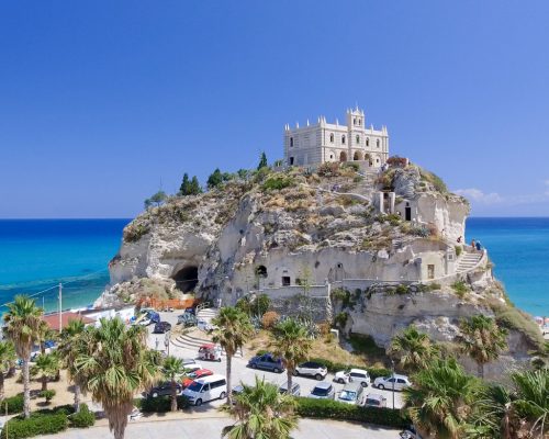
Calabrian coast by bicycle
Pedal to the sound of the waves at the tip of your boot. A ten-day journey on two wheels, to be realised with the help of trains and buses.
The star of this itinerary, which does not require athletic legs, is the sea as a landscape, but we should not overlook the attraction of some charming villages and the vestiges of ancient civilisations, which bear witness to a millenary historical heritage. Cycling gives you the opportunity to cut through the side streets, but at the same time not to miss out on the most valuable things the region has to offer and this without ever having to look for a parking space.
The stations I have used are Praia, Tropea, Pizzo, Scilla, Catanzaro Lido, Locri, Roccella Ionica, Monasterace, Badolato, Crotone, Botricello. However, by using the local bus lines you can avoid tiring uphill rides. For example, to go from Locri railway station to Gerace (9 km uphill) you can travel with Mediterranea trasporti tel. 0965-639009, while to travel from Monasterace to Stilo you can ask for the assistance of Autolinee Federico tel. 0964-232733, www.autolineefederico.it.
The SS106 from Crotone to Catanzaro Lido is connected by the Romano via Ruffo, 16 – Crotone, tel. 0962.21709, the only problem is that the stops are not signposted in any way.
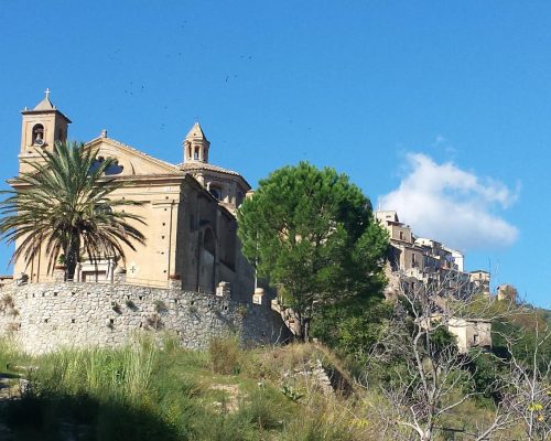
Badolato Marina, Caminia, Copanello, Scolacium Archaeological Park in Roccelletta
Take the small train to Badolato Marina, and from there cycle back to most of the beaches to see what they’re like and try to leave the roar of the SS 106 behind as much as possible. Badolato’s seafront is quite ‘rustic’, with a few bathing establishments, but in general, the environment is quite natural: the problem is that because of the fiumare – that are, seasonal watercourses – which separate the various seaside resorts, it is never possible to go from one lido to another using the secondary road without returning to the state road. There is also another difficulty: the tracks are often a barrier to get from the 106 to the sea and vice versa, so you have to find a subway or an overpass. However, the flat coastline after the Badolato marina to beyond Sant’Andrea dello Ionio is wonderful, the coast is miraculously intact, fringed with pine forests, olive groves and citrus orchards, among which you can ride a mountain bike.
A little further on, you pass through Soverato and Pietragrande, beaches that have succumbed to mass tourism and where the race for building speculation has begun to harm the environment.
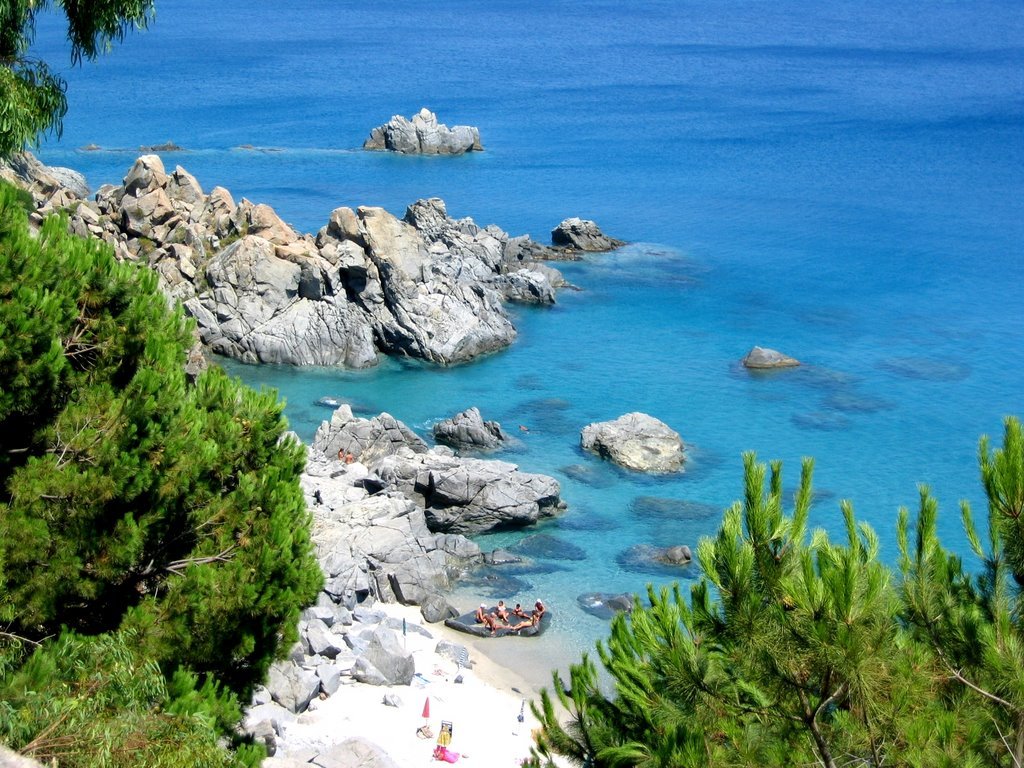
Just beyond a fabulous viewpoint, located on the granite cliffs overlooking the sea at Caminia, on the left, a slightly ajar gate provides access to a section of the old 106 that is not open to traffic. Admittedly, because of the landslides, it is a little dangerous to venture along this road, which involves a steep climb. My back badly absorbs the jolting of the bike, which slips through the numerous potholes in the road surface and sometimes slips in the mud, but at least there are no cars here and you have a breathtaking view. In order to exit from the opposite side, someone has cut a triangular-shaped gap in the barrier fence, through which the bicycle can be passed. From this point on it is necessary to pay a lot of attention to cars again. Shortly before the Copanello tunnel, a steep descent to the right -via S. Martino- leads to the basins of Cassiodorus, natural pools that open up between the rocks, used as fish farms, which were once located next to the monastery founded by Cassiodorus (a politician and writer, born in 490 AD to a family of Syrian origin who moved to Calabria, but grew up in Ravenna, at the court of Theodoric). Along the road you can also see the ruins of a small religious building, the small church of St Martin.
Exiting the gallery of Copanello you can go down to the lido of the same name, which is a well-known and popular tourist resort, although I don’t understand why, since I saw it unkempt, dirty, with palm trees burnt by the salt and frayed by the sea breeze, with bulky bars, restaurants and resorts that ruin the view.
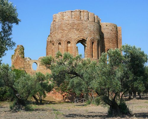
A few kilometres from Catanzaro Lido, in Roccelletta di Borgia, stands the Scolacium archaeological park, beautifully set in a rural context. Fortunately for archaeologists, the village of Squillace grew away from the remains of the ancient Roman city founded around 123 BC and not on top of them, as sometimes happens. Excavations began in 1966 and uncovered the ruins of a theatre, amphitheatre and forum, the remains of which are scattered on the slopes of a hill above the sea and surrounded by a beautiful expanse of olive trees. Little more than a memory remains of Skylletion, a Magna Graecia settlement from the 6th century BC. I suggest starting with a visit to the museum, which is an essential preparation for a visit to the adjacent archaeological area. The collections, which have recently undergone a new display, include a series of togatus statues, heads of prominent figures from the colony, as well as metal and ceramic artefacts from excavations in the main areas of the settlement.
At the Lido di Roccelletta di Borgia, a vast pine forest stretches out right next to the beautiful sandy beaches beaten by the waves. The only negative element that offends such beauty is the rubbish!
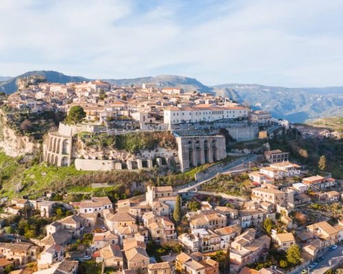
Locri-Gerace Archaeology and ancient village
You take the train and get off at Locri station. A Mediterranea minibus leaves from the station square for Gerace. The driver authorises me to load my two-wheeler between the seats. In about twenty minutes I am already climbing the slope of via della Resistenza and, having reached the opening of the Baglio, I remain open-mouthed in front of the grandiose ruined remains of the Norman castle, because the dazzling colours of the sky and mountains, which provide an attractive backdrop, are enhanced by the clarity of the air and the whole is a spectacle for the eye and the spirit.
Since I am now at the highest point in Gerace, I have no choice but to go down, so I head down Via Buonarroti and find myself in Piazza Tribuna, overlooked by the grey semi-cylindrical apses of the stunning Byzantine-Norman cathedral. The interior, with three naves, has simple and elegant lines.
Leaving the cathedral and taking Via Caduti sul Lavoro, you reach Piazza delle Tre Chiese, where you can admire the Church of the Sacred Heart, the Church of San Francesco and the Greek Orthodox Church of San Giovannello, the smallest and prettiest of them all. Then, as you wander through the labyrinth of alleyways in the Upper Town, you catch a glimpse of small but precious details, such as the two Catalan mullioned windows of Palazzo Delfino. From Piazza del Tocco, formerly the site of public meetings, you can take Via Sottoprefettura to the Belvedere delle Bombarde, which offers a breathtaking view of the Ionian coast.
Continuing on to via Roma to the Borghetto district and, after passing through the city gate, it’s a quick ride along the SP1 to the secluded district of Piana, where there is a pine forest offering superb views of the old town, whose happy position on a sheer sandstone mound is appreciated. Once past Borgo Maggiore, you descend without pedalling, free-falling, for about 8 km along the former Locri-Gioia Tauro state road along a winding route that follows the hills to the intersection with the 106.
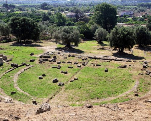
Three more kilometres of 106 on the flat and you are in Locri Epizephiri. The area of the excavations of the Magna-Greek town of Locri (municipium romano from 89 B.C.), does not make a significant impression, although it is rather articulated and covers an area of about 300 Ha, since only the stone perimeter of all the buildings is visible: the vertical element is missing and has been lost over the centuries. In particular, the suburban area known as Centocamere, despite the fact that the route is signposted with explanatory panels, leaves the tourist somewhat lost.
The most conspicuous portion of the site is in contrada Marasà, where a single column from an Ionic temple has been relocated on a modern block. The Macrì Casino, if it is open (which is not to be taken for granted as its opening hours are very short), should not be missed: as here one can see the bulk of a Roman public baths building, dating back to the second century A.D. which was never completed or put into operation and, in a farmhouse next to the farmhouse, one can contemplate the first-century A.D. marble statue of the Toga of Petrara, perhaps a magistrate of the Roman Locri.
The National Archaeological Museum is also an essential part of the visit. Particularly noteworthy among the various finds are the pínakes, fragments of thin votive tablets in very low relief, dating from the 5th century BC, found in the sanctuary of Persephone at Mannella: these were gifts that pilgrims brought as a tribute to the goddess.
Leaving the museum area and taking a country lane running eastwards along with the enclosure of the archaeological zone, on the opposite side of the entrance, we gain access by stealth (officially closed, but accessible through a huge hole in the fence), to the Greek theatre dating from the 4th century B.C. It was renovated at the time of the Roman Empire to host bloody gladiatorial circus shows and scenographically arranged along the slopes of a hill sloping down towards the sea. The cavea, the area reserved for the public, could seat between 4,500 and 5,000 people, and one can still sense how elegant and grandiose the building must have been in its heyday, even though only rubble now remains.
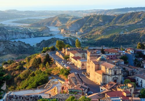
Stilo. The ancient country, the Byzantine Catholic.
You arrive by train at Monasterace Marina and to avoid the effort of the climb you can reach Stilo by an Autolinee Federico bus. In the town where Tommaso Campanella was born, I was fascinated by the Cattolica, a marvel of harmony, with its five brick domes decorated in terracotta and its dominant position over the valley carved by the Stilaro river. On the way back, all I have to do is indulge in the thrill of the descent along the SS110, which winds its way through curves and counter-curves for 15 km to Monasterace Marina. I round off the day by enjoying the last few pedal strokes in the Giovino pine forest and on the beaches of Simeri, Ruggero and Sellìa, perfect for healthy walks in the midst of generous vegetation.
OTHER ITINERARIES
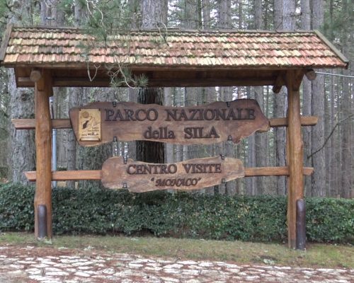
Mancuso Village (Small Sila)
Route: The route will have a total length of about 55 km, 80% of which will be on dirt roads. An initial stretch of about 9 km on asphalt will take us to the start of the adventure that will unfold in the Sila Piccola National Park.
Medium level of technical and athletic difficulty.
Departure will be from Villaggio Mancuso, Hotel Olimpo.
There will be paths unknown to mass tourism, made practicable for the occasion, along which it will be possible to see typical rocky monoliths, true natural sculptures, majestic conifer and beech woods, fascinating watercourses and enchanting waterfalls, not excluding the possibility of seeing wild animals such as wild boar, foxes and roe deer. We will experience a day completely immersed in nature and far from any human settlement.
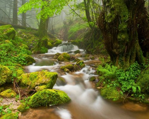
Cardinal - Serre Park
The route covers 25 km, 90% of which is gravel and 10% asphalt, towards the most beautiful and unspoilt areas of the Parco delle Serre, where Sila and Aspromonte meet.

